Exploring the African Great Lakes Region Map
The African Great Lakes Region Map offers a fascinating glimpse into a geographically diverse and historically rich area. This region, dominated by vast freshwater lakes, is home to a complex tapestry of cultures, wildlife, and natural resources. Understanding this region through its map is crucial for comprehending its complexities. The map reveals not only the geographical layout but also the political boundaries, highlighting the intricate relationship between the natural landscape and human interventions.
Unveiling the Geography of the African Great Lakes Region Map
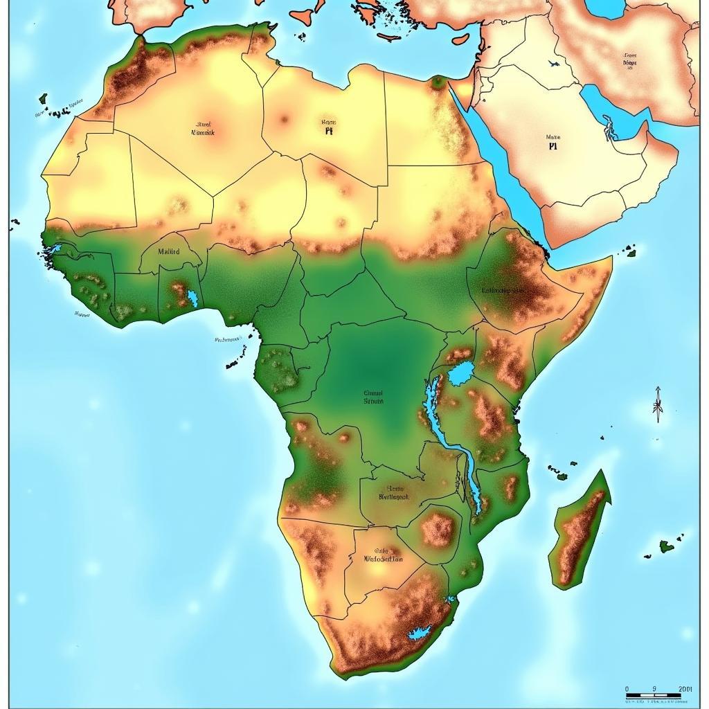
The African Great Lakes region, nestled in East and Central Africa, is defined by its namesake: a series of interconnected freshwater lakes. These include Lake Victoria, the largest lake in Africa and the second largest freshwater lake in the world; Lake Tanganyika, the longest freshwater lake globally; and Lake Malawi, known for its incredible biodiversity. The region also includes smaller but equally significant lakes such as Lake Kivu, Lake Edward, and Lake Albert. The African Rift Valley plays a significant role in the formation and continued evolution of these lakes, shaping the dramatic landscapes surrounding them.
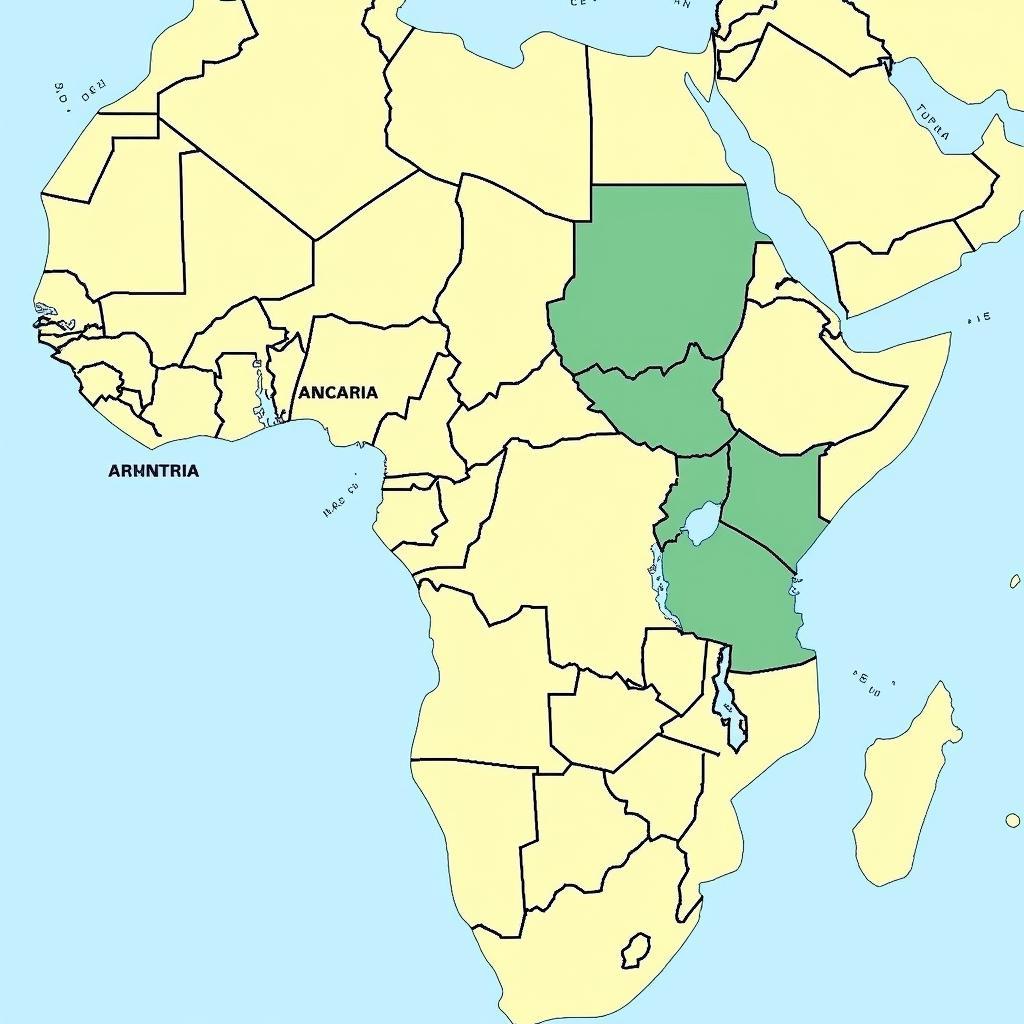
The region encompasses several countries including Burundi, Rwanda, Uganda, the Democratic Republic of Congo, Tanzania, Kenya, and parts of Zambia and Malawi. The topography is varied, ranging from volcanic mountains and lush rainforests to expansive savannas and arid plains. This diversity in landscape directly influences the distribution of human populations and the intricate web of ecological interactions within the region.
 Physical map of the African Great Lakes Region showcasing topography and major lakes
Political Boundaries and the African Great Lakes Region Map
Navigating the political landscape of the African Great Lakes region requires a detailed understanding of the map. The region’s history is marked by fluctuating borders and the legacy of colonialism. The African Great Lakes region conflicts are a stark reminder of the complex political dynamics and the ongoing challenges faced by the nations within this area. A careful examination of the map reveals the often arbitrary nature of these boundaries, which have at times exacerbated tensions and contributed to conflict. Understanding these political divisions is key to comprehending the present-day challenges and potential future trajectories of the region.
The influence of colonialism continues to shape the region, impacting not only the political structure but also economic development and social dynamics. The map reveals how these historical forces have played a role in shaping the current realities of the African Great Lakes region.
 Political map of the African Great Lakes Region displaying countries and borders
Why is the African Great Lakes Region Map Important?
Why bother understanding the African Great Lakes region map? Because it’s a key to unlocking the region’s rich past, complex present, and potential future. The map isn’t just a static representation of geography; it’s a dynamic tool for understanding the interconnectedness of environmental, political, and social factors that shape this vibrant area.
- Understanding Biodiversity: The map helps visualize the distribution of unique ecosystems and biodiversity hotspots, crucial for conservation efforts.
- Resource Management: The region’s natural resources, including water, minerals, and fertile lands, are highlighted on the map, providing insights into their distribution and the challenges of sustainable management.
- Conflict Resolution: The map aids in understanding the historical and geographical context of conflicts, contributing to more effective peacebuilding initiatives.
Professor Charles Mwita, a renowned geographer specializing in the African Great Lakes region, emphasizes the importance of understanding the map: “The map provides a crucial lens through which we can understand the complex interplay of factors shaping this region. It allows us to see the connections between geography, history, and human activity.”
Navigating the African Great Lakes Region Map
How can you effectively use an African Great Lakes region map?
- Identify the Lakes: Locate the major lakes and understand their relative sizes and positions.
- Trace the Rivers: Follow the rivers and tributaries that connect the lakes and shape the drainage basins.
- Recognize the Countries: Identify the countries within the region and their bordering nations.
Dr. Amina Mwangi, a historian specializing in East African history, adds, “The map provides a foundation for understanding the complex history and interconnectedness of the people and cultures in this region. It is a starting point for exploring the rich tapestry of human experience.”
The African republic map and the African countries map HD can provide broader context. Furthermore, exploring the African Rift provides insight into the geological forces shaping the region.
Conclusion
The African Great Lakes region map is an essential tool for anyone seeking to understand this complex and dynamic part of the world. By exploring the map, we can gain a deeper appreciation for the intricate relationship between geography, history, and human activity in shaping the African Great Lakes region. Understanding the African Great Lakes region map unlocks the door to understanding this unique and vital area.
FAQ
- What are the major lakes in the African Great Lakes region?
- Which countries are included in the African Great Lakes region?
- What is the significance of the African Rift Valley in this region?
- What are the major resources found in the African Great Lakes region?
- What are some of the key challenges facing the region?
- How can the map help in understanding the region’s biodiversity?
- What is the historical significance of the African Great Lakes region?
For further information on related topics, explore our articles on the African Rift Valley and the African Great Lakes region conflicts. We encourage you to delve deeper into the fascinating world of the African Great Lakes.
When you need assistance, please contact us via Phone: +255768904061, Email: kaka.mag@gmail.com, or visit us at Mbarali DC Mawindi, Kangaga, Tanzania. We have a 24/7 customer service team ready to assist you.

